|
16th September 2020
The J.Lyons LEO 1 computer was constructed and operated on the second floor of the WX Block at Cadby Hall, Hammersmith, London. The 'calculator room' was roughly 2,500 sq feet and had large sash windows on opposite sides of the room. Several LEO 1 'users' have told me that the smell of the Lyons bakeries would waft through open windows and mix with the history-making activity that was being undertaken in that remarkable room.
Inside the room the view was dominated by 21 7ft+ racks of hot valves and electronics, purring to the demands of a program and spitting out results of calculations to large noisy printers and punched card machines. But if you could take your eyes off the inside of the room for a minute and go to one of the windows, what would you see? This was a room with a view, but a view of what?
To ensure the realism of the Virtual Reality version of the LEO 1 installation, we have to answer the question; what was the view from those windows? What was outside the calculator room at that time?
Charles Cadby, a piano manufacturer, had in 1874 acquired a 1.5-acre site off of what will become the Hammersmith Road in West London. The site was complex and consisted of many buildings and after his death in 1884, occupied by many different owners. But by 1899 J. Lyons had purchased 62 Hammersmith Road and from there took over the Hall and many surrounding properties eventually to cover over 13 acres. The site would be known as Cadby Hall and become one of the largest food factories in the UK.
We have to make sense of this sprawling site and place the calculator room at the correct location. Only then can we work out what the view was from the windows.
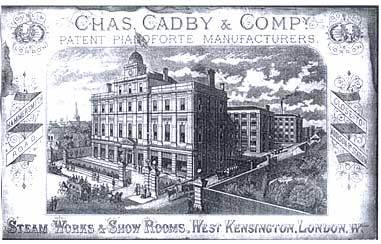
The original Cadby Hall looked like this.
An aerial image (below) taken in 1921 is the first step to understanding the Cadby Hall site.
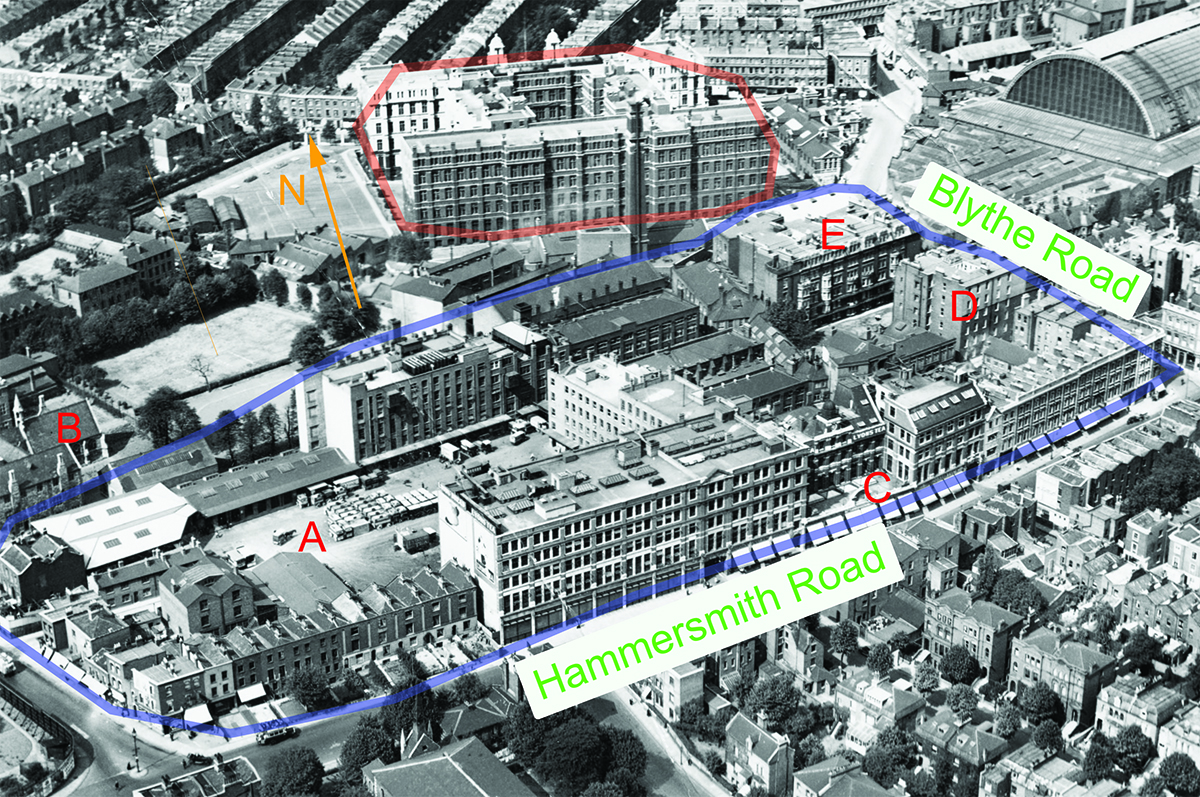
The site owned and operated by Lyons is outlined in blue. You can see the Lyons vans in the yard at point A.
The large curved building to the top right is Olympia, the exhibition hall and the impressive building behind the Lyons site (marked in red) is Blythe House, originally built as the headquarters of the Post Office Savings Bank. The building at location B is St. Mary's College, used to train teachers. This will be moved in 1925 and Lyons will acquire the college site and significantly increase their available space.
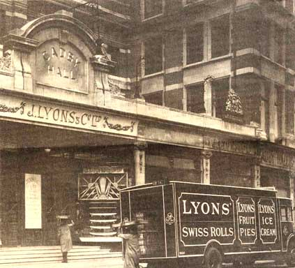
At point C you can see the original Cadby Hall, so tiny compared to the rest of the site. Addison Mansions is located at point D and the building opposite (point E) once demolished, will be the site upon which the WX Block will be built. But not yet!
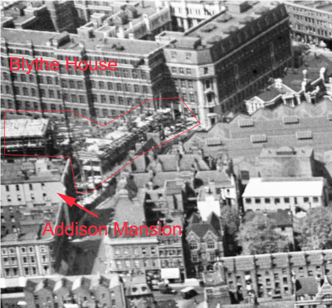
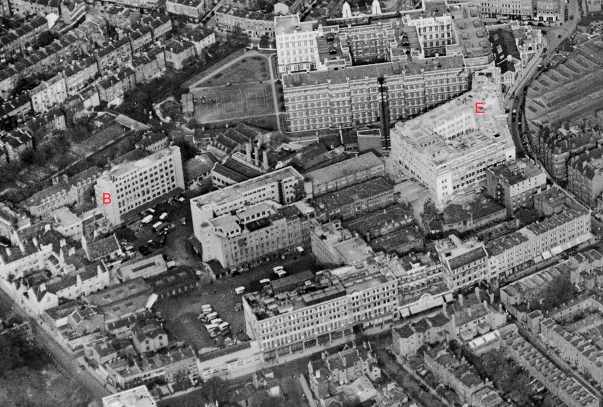
Aerial photography taken in April 1928 (below) shows that the building that was at point E, has been demolished and you can just see a new building under construction, circled in red with Blythe House behind and Addison Mansions in front. The scaffolding is clearly in view.
By October 1928 the new WX building is complete (E) shown below. It is very light in colour and it will take a few years of the smokey London air to darken this new building. It curves to the line of Blythe Road and includes a central quadrangle, presumably to let more light in. Notice also that the St Mary's College 'greens' at the back of the College building has been built on (B), although the College building itself is still there.
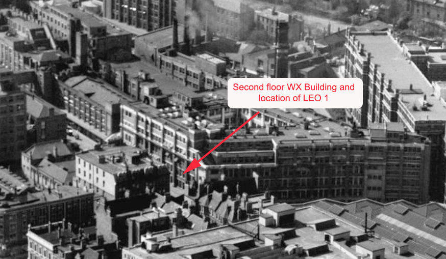
The photograph below was taken in April 1949 and shows the completed WX building with the second floor arrowed to show the windows of the room that will become the 'calculator room' before the end of that year. It is clear from this photograph and others that the (peripheral side) looks out onto the opposite side of the WX building quadrangle. On the side of the calculator room, shown in the photograph (the LEO side), the view was much dominated by Addison Mansions, shown below.
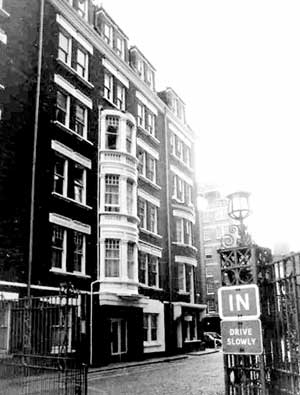
Addison Mansions
The other half of the calculator room would have seen to the right of Addison Mansions into a yard and many more buildings into the distance. Some London skyline was probably in view perhaps somewhat murky with the poor air of London in the 1950s.
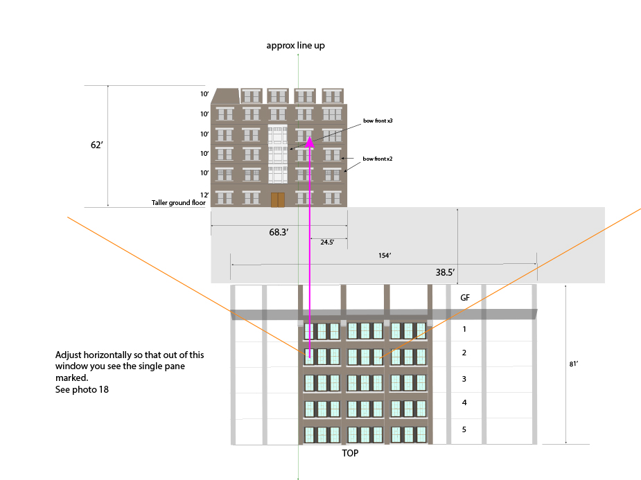
Work is being undertaken to estimate the views from the calculator room windows. This involves estimating building sizes, heights, angles, and possible look.
This earlier photograph from 1947 (below), clearly shows Elms House has been constructed (arrowed), over the road from the Cadby Hall site. Elms House at some point in the future, will host LEO 2 and take its part in this fascinating story.
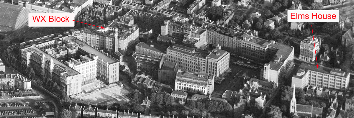
Having established the location of the calculator room and the buildings around it, we will slowly assemble a better estimate for what might have been seen out of those windows, at least for a short time before the people in the calculator room returned their attentions to the world's first business computer and the work of the day.
I must pay tribute to the website Britain from Above, which is a brilliant resource supported by, amongst others, The National Heritage Lottery Fund. You can find it here: https://britainfromabove.org.uk/en
Posted by: Chris Monk
|


